Search Results
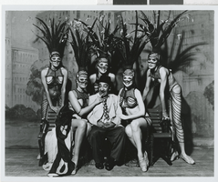
Photograph of Tommy "Moe" Raft and dancers in Minsky's Burlesque at the Aladdin Hotel and Casino, Las Vegas (Nev.), 1972
Image
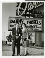
Photograph of Mr. and Mrs. Arlo Herring at the Sands Hotel and Casino, Las Vegas, May 21, 1965
Image
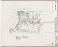
Architectural drawing of the Riviera Hotel and Casino (Las Vegas), master plan for the first floor, February 3, 1984
Drawing of proposed changes to the Riviera as submitted to the planning commission from 1984. Site plan depicting structure on the corner of Las Vegas Boulevard and Riviera Boulevard. Printed on mylar.
Site Name: Riviera Hotel and Casino
Address: 2901 Las Vegas Boulevard South
Image
News conference for new "Casino Poker" game at Vegas World with host David Sklansky: video, 1982 March 04
Text introduces "Bob Stupak's Vegas World introduces the new table game "Casino Poker" where players can play poker against the casino, not other players" and note the gaming authority has approved it for a field test at Vegas World; news conference with David Sklanksy, Puggy Pearson, Doyle Brunson, Sailor Roberts, and Johnny Moss (all World Poker Champions); David Sklansky narrates over the casino poker game, summary text appears on screen. Original media VHS, color, aspect ratio 4 x 3, frame size 720 x 486.
Collection Name: Bob Stupak Professional Papers
Box/Folder: Digital File 00, Box 41
Archival Component
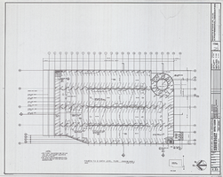
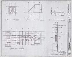
Architectural drawing of the Showboat Hotel and Casino (Atlantic City), parking plan, fourth to eighth level plan, 1985
Fourth to eighth level parking structure plans for the construction of the Showboat Hotel and Casino in Atlantic City from 1985. Includes revision dates and key plan. Parchment copy.
Site Name: Showboat Hotel and Casino (Atlantic City)
Address: 801 Boardwalk, Atlantic City, NJ
Image
Architectural drawing of the Showboat Hotel and Casino (Atlantic City), ceiling plan, fifth and 24th floor, 1985
Fifth and 24th floor reflected ceiling plans for the construction of the Showboat Hotel and Casino in Atlantic City from 1985. Includes revision dates and key plan. Parchment copy.
Site Name: Showboat Hotel and Casino (Atlantic City)
Address: 801 Boardwalk, Atlantic City, NJ
Image
The STRAT Hotel, Casino & Skypod - Las Vegas, NV: archived website, 2016 to 2022
Collection Name: University of Nevada, Las Vegas Gaming Web Archive
Box/Folder: N/A
Archival Component
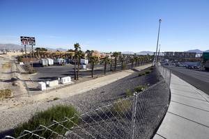
Exterior view of the Lucky Club Casino in daylight, looking northeast in North Las Vegas, Nevada: digital photograph
From the UNLV University Libraries Photographs of the Development of the Las Vegas Valley, Nevada (PH-00394). Part of the collection documents the entire 19 mile length of the north/south Eastern Avenue / Civic Center Drive alignment. This photograph was captured in the section of Civic Center Drive between Alexander Road and Cheyenne Avenue.
Image
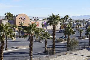
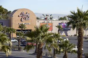