Skip to main content
Main navigation
Finding Aids
Digital Projects
African American Experience in Las Vegas
Charles Saladino Landscape Architecture Collection
Culinary Union Photograph Collection
Dino at the Sands
Dreaming the Skyline
Entertainment
Historic Landscape of Nevada
Hoover Dam
Jamey Stillings
Menus: The Art of Dining
Nevada Test Site Oral History Project
Newspapers
Oral Histories Collection
Photograph Collections
Rebel Yell Newspaper
Showgirls
Southern Nevada: The Boomtown Years 1900-1925
Southern Nevada History in Maps
Southern Nevada Jewish Heritage Project
UNLV CSUN Records
Union Pacific Railroad Water Documents
Walking Box Ranch Collection
Welcome Home Howard
About
Request Images
Help
Provide Feedback
Special Collections Home
Search the Special Collections and Archives Portal
Search
Search
Breadcrumb
Special Collections and Archives Portal
Nevada
Authority Link
GeoNames
Broader
United States
Feature
first-order administrative division
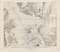
Map of part of Las Vegas Valley, Nevada, showing changes in the piezometric surface between February 1944 and February 1956
Image
View
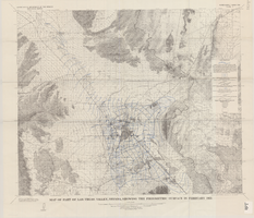
Map of part of Las Vegas Valley, Nevada, showing changes in the piezometric surface between February 1955 and February 1956
Image
View
Map of part of Las Vegas Valley, Nevada, showing the piezometric surface in September 1955
Image
View
Map of part of Las Vegas Valley, Nevada, showing the piezometric surface in February 1955
Image
View
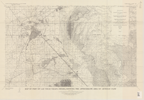
Map of part of Las Vegas Valley, Nevada, showing the approximate area of artesian flow, 1965
Image
View
Map of the Las Vegas ground-water basin, Clark, Nye, and Lincoln Counties, Nevada, 1965
Image
View
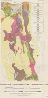
Geologic map and sections of Muddy Mountains, St. Thomas Gap, and part of the Grand Wash Cliffs, 1928
Image
View
Geologic map and sections of area along Colorado River between Lake Mead and Davis Dam, Arizona and Nevada, 1963
Image
View
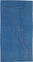
Cross-section maps of Combination and Florence Mines, Goldfield, Nevada, circa 1902-1908
Image
View
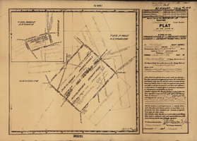
Plat of the Texas and Lone Star Lodes, May, 1905
Text
View
Map of mines owned and operated by Goldfield Deep Mines Company of Nevada, circa 1904-1908
Image
View
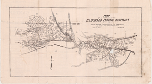
Map of a portion of the Eldorado Mining District, November 1916
Text
View
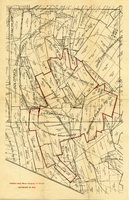
Plat of the claim of George Wingfield, June, 1907
Text
View
Longitudinal section map, Montana Tonopah Mine, circa 1900s-1910s
Image
View
Fairday Mine property map, May 25, 1916
Image
View
Map of Kawich Quadrangle, Nye County, Nevada, June 1908
Text
View
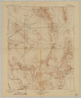
Map of Ely Range Quadrangle, Lincoln County, Nevada, 1921
Image
View
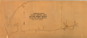
Map of underground workings in Potosi and Central Lodes, May 1906
Image
View
Pagination
First page
« First
Previous page
‹‹
…
Page
55
Page
56
Page
57
Page
58
Current page
59
Page
60
Page
61
Page
62
Page
63
…
Next page
››
Last page
Last »