Skip to main content
Main navigation
Finding Aids
Digital Projects
African American Experience in Las Vegas
Charles Saladino Landscape Architecture Collection
Culinary Union Photograph Collection
Dino at the Sands
Dreaming the Skyline
Entertainment
Historic Landscape of Nevada
Hoover Dam
Jamey Stillings
Menus: The Art of Dining
Nevada Test Site Oral History Project
Newspapers
Oral Histories Collection
Photograph Collections
Rebel Yell Newspaper
Showgirls
Southern Nevada: The Boomtown Years 1900-1925
Southern Nevada History in Maps
Southern Nevada Jewish Heritage Project
UNLV CSUN Records
Union Pacific Railroad Water Documents
Walking Box Ranch Collection
Welcome Home Howard
About
Request Images
Help
Provide Feedback
Special Collections Home
Search the Special Collections and Archives Portal
Search
Search
Breadcrumb
Special Collections and Archives Portal
Nevada
Authority Link
GeoNames
Broader
United States
Feature
first-order administrative division
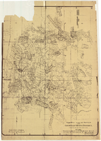
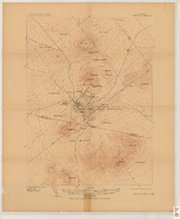
Map of the 450 foot level of the Mohawk Mine, Goldfield, Nevada, circa 1902-1908
Image
View
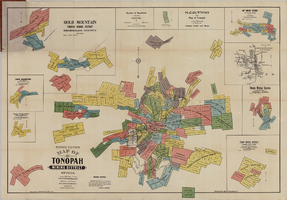
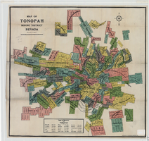
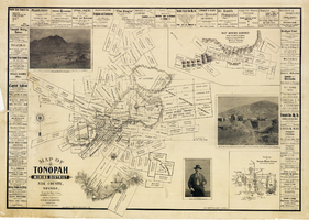
Map of Tonopah Mining District, Nevada, revised edition, 1903
Image
View
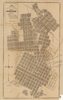
Map of Goldfield, Nevada, April 25, 1907
Image
View
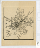
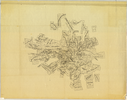
Map of Tonopah Mining District, Nye County, Nevada, circa 1903
Image
View
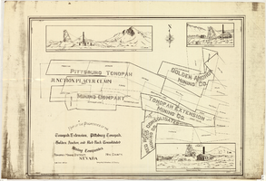
Map of properties in the Tonopah Mining District, Nye County, Nevada, circa 1901
Image
View
Map of approved mineral surveys in the Goldfield Mining District, Esmeralda and Nye Counties, Nevada, 1911
Image
View
Map of Tonopah Mining District, Nevada, 1905
Image
View
Map of Tonopah Mining District, Nevada, circa 1905
Image
View
Tonopah, Nevada mining map, March 1904
Text
View
Map of Death Valley showing principal points of interest and Furnace Creek Inn, and Amargosa Hotel, circa 1930s
Image
View
Map showing proposed annexation of Las Vegas Valley, Clark County, Nevada, January 1, 1929
Image
View
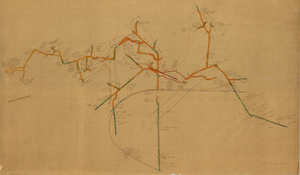
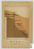
Vertical cross-section of Eureka Consolidated Mine, 1883
Image
View
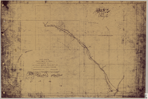
Map showing right of way of toll road constructed by Nevada Rapid Transit Co. in Lincoln County, State of Nevada
Image
View
Map of Tonopah Mining District, Nye County, Nevada, 1902
Text
View
Map of Searchlight mining district, Clark County, Nevada, circa 1905
Image
View
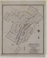
Map of Argentite Red Mountain Mining District, Esmeralda County, Nevada, circa 1908-1913
Image
View
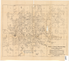
Map of the Goldfield Mining District, Goldfield, Nevada, 1907
Image
View
Map of U.S. patent and location surveys in the Goldfield Mining District, Esmeralda and Nye Counties, Nevada, 1907
Text
View
Pagination
First page
« First
Previous page
‹‹
…
Page
57
Page
58
Page
59
Page
60
Current page
61
Page
62
Page
63
Page
64
Page
65
…
Next page
››
Last page
Last »